 |
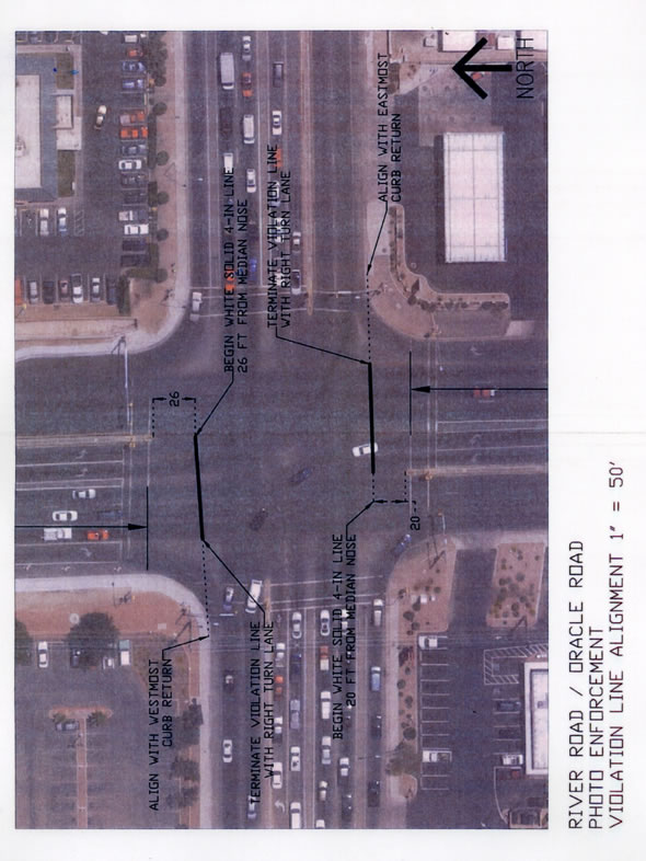
Aerial photo of the intersection of River Road and Oracle Road, showing photo enforcement violation line adjustment, at a scale of 1 inch = 50 feet. The violation line on the southbound approach is shown starting at a point 26 feet south of the south end of the median, extending westward, and ending at a point aligned with the west most curb return at the eastern edge of the southbound right turn lane. The violation line on the northbound approach is shown starting at a point 20 feet north of the north end of the median, extending eastward, and ending at a point aligned with the east most curb return at the western edge of the northbound right turn lane.
|
United States Department of Transportation - Federal Highway Administration |
||